La Sagnette/Les Tourbières, Les Verrières
Perimetro protetto sulla carta nazionale
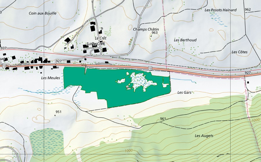
Posizione e dintorni
La Sagnette/Les Tourbières è registrato nell’inventario federale come torbiera bassa. Il sito si trova presso Les Verrières. Si estende su 7 ha. Nell’inventario federale porta il numero d’oggetto 1471. Entro un raggio di 25 chilometri si trovano altri 8 siti protetti. I dati provengono dall’inventario federale e vengono aggiornati a ogni revisione.
Nelle vicinanze
Domande frequenti
Dove si trova La Sagnette/Les Tourbières?
La Sagnette/Les Tourbières si trova presso Les Verrières. Le coordinate sono 46.9058, 6.4997.
Quanto è grande La Sagnette/Les Tourbières?
Il sito si estende su 7 ha secondo l’inventario federale.
Torbiera bassa: che cos’è?
Le torbiere basse sono alimentate da acqua sotterranea o di versante e ospitano molte specie specializzate.
La Sagnette/Les Tourbières è protetto?
Sì. Il sito è iscritto nell’inventario federale ed è quindi d’importanza nazionale.
A quale comune appartiene La Sagnette/Les Tourbières?
La Sagnette/Les Tourbières si trova presso La Côte-aux-Fées. La pagina della località raccoglie tutti i siti protetti attorno a La Côte-aux-Fées.
Quali siti protetti si trovano vicino a La Sagnette/Les Tourbières?
I più vicini sono La Sagnette/Les Tourbières (0 km), Les Côtes (2 km) e Les Replans (2 km).