Col des Mosses/La Lécherette, Les Mosses
Protected perimeter on the national map
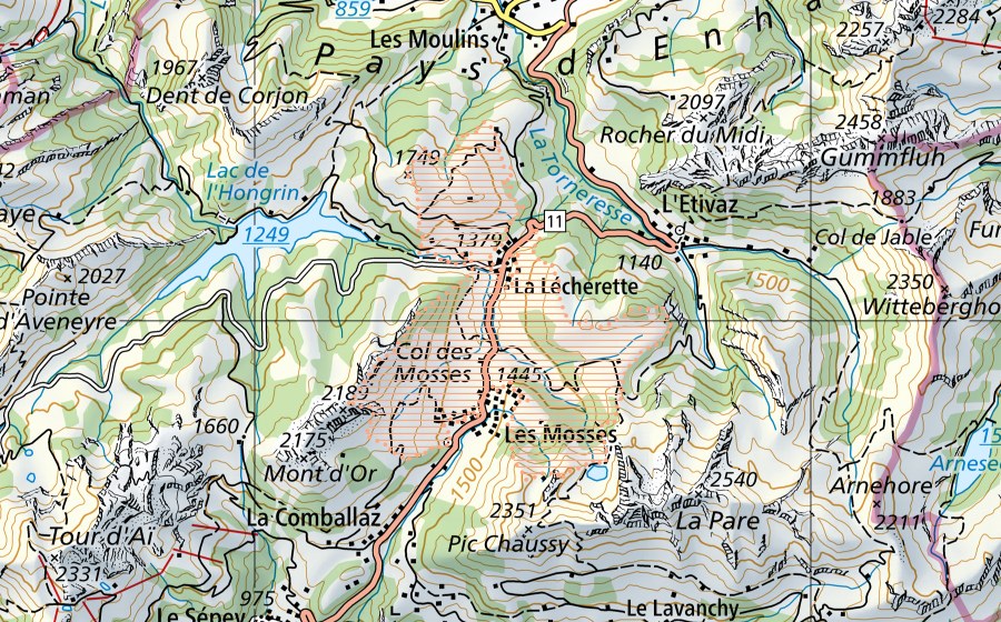
Location and surroundings
Col des Mosses/La Lécherette is a mire landscape in Switzerland. The site lies near Les Mosses in the canton of VD. It covers 1 588 ha. In the federal inventory it carries object number 99. Within 25 kilometres there are 8 further protected sites. The figures come from the federal inventory and are updated at each revision.
Nearby
Frequently asked questions
Where is Col des Mosses/La Lécherette?
Col des Mosses/La Lécherette lies near Les Mosses in the canton of VD. The coordinates are 46.4125, 7.1060.
How large is Col des Mosses/La Lécherette?
The site covers 1 588 ha according to the federal inventory.
Mire landscape: what is it?
Mire landscapes are large landscapes containing bogs, protected for their beauty and national importance. Switzerland has 102 of them.
Is Col des Mosses/La Lécherette protected?
Yes. The site is listed in the federal inventory and is therefore of national importance.
Which town is Col des Mosses/La Lécherette in?
Col des Mosses/La Lécherette lies near Ormont-Dessous (VD). The town page collects every protected site around Ormont-Dessous.
Which protected sites are near Col des Mosses/La Lécherette?
The closest are Communs des Mosses, est (0 km), L'Arsat (0 km) and Communs des Mosses, ouest (0 km).