Arbächnubel, Wiler (Lötschen)
Protected perimeter on the national map
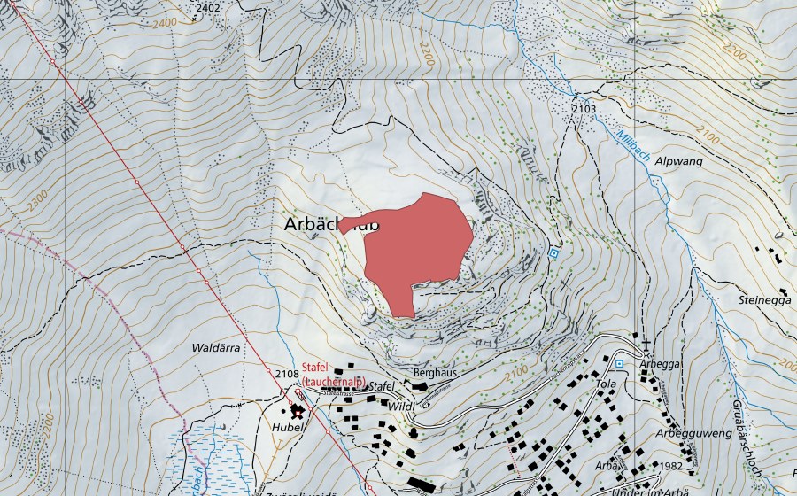
Location and surroundings
Arbächnubel is a dry meadow in Switzerland. The site lies near Wiler (Lötschen). It covers 3 ha. In the federal inventory it carries object number 7099. Within 25 kilometres there are 8 further protected sites. The figures come from the federal inventory and are updated at each revision.
Nearby
Frequently asked questions
Where is Arbächnubel?
Arbächnubel lies near Wiler (Lötschen). The coordinates are 46.4172, 7.7714.
How large is Arbächnubel?
The site covers 3 ha according to the federal inventory.
Dry meadow: what is it?
Dry meadows and pastures are nutrient-poor, sunny grasslands of exceptional biodiversity, created only by traditional management.
Is Arbächnubel protected?
Yes. The site is listed in the federal inventory and is therefore of national importance.
Which town is Arbächnubel in?
Arbächnubel lies near Kippel. The town page collects every protected site around Kippel.
Which protected sites are near Arbächnubel?
The closest are Turand (1 km), Rufinu (2 km) and Ritzmad (2 km).